Welcome to FLYBO!

A Unified Benchmark Environment for Autonomous Flying Robots
teaser-hi.png
An MAV equipped with odometry- and active depth sensors autonomously explores a complex synthetic area from FLYBO (a) while gradually mapping the scene throughout different exploration stages and planning trajectories online (b-d). Simultaneously, the perceived surfaces are also reconstructed online (close-up views). FLYBO provides datasets, references and a framework to benchmark such systems with respect to their volumetric exploration and online surface reconstruction capabilities.

Overview

The use of Micro-Aerial Vehicles (MAVs) equipped with odometry- and depth sensors has become predominant for a wide variety of challenging industrial applications such as the autonomous exploration (ie, digital mapping), and inspection (ie, online surface reconstruction) of unknown facilities. However, despite the ongoing attention these topics receive, autonomous exploration systems still lack common evaluation grounds to assess their relative performance in terms of data and experimental tools.
We address this deficit by introducing FLYBO, the first unified benchmark environment that focuses on the performance of such flying robots in terms of autonomous exploration and online surface reconstruction. 

FLYBO includes the following contents:
(i) a comprehensive benchmark of 7 of the top-performing autonomous exploration algorithms including methods without publicly available code.
(ii) A unified experimental system factorizes the routines shared by autonomous planners in order to fairly and accurately assess their exploration performance in a controlled environment. 
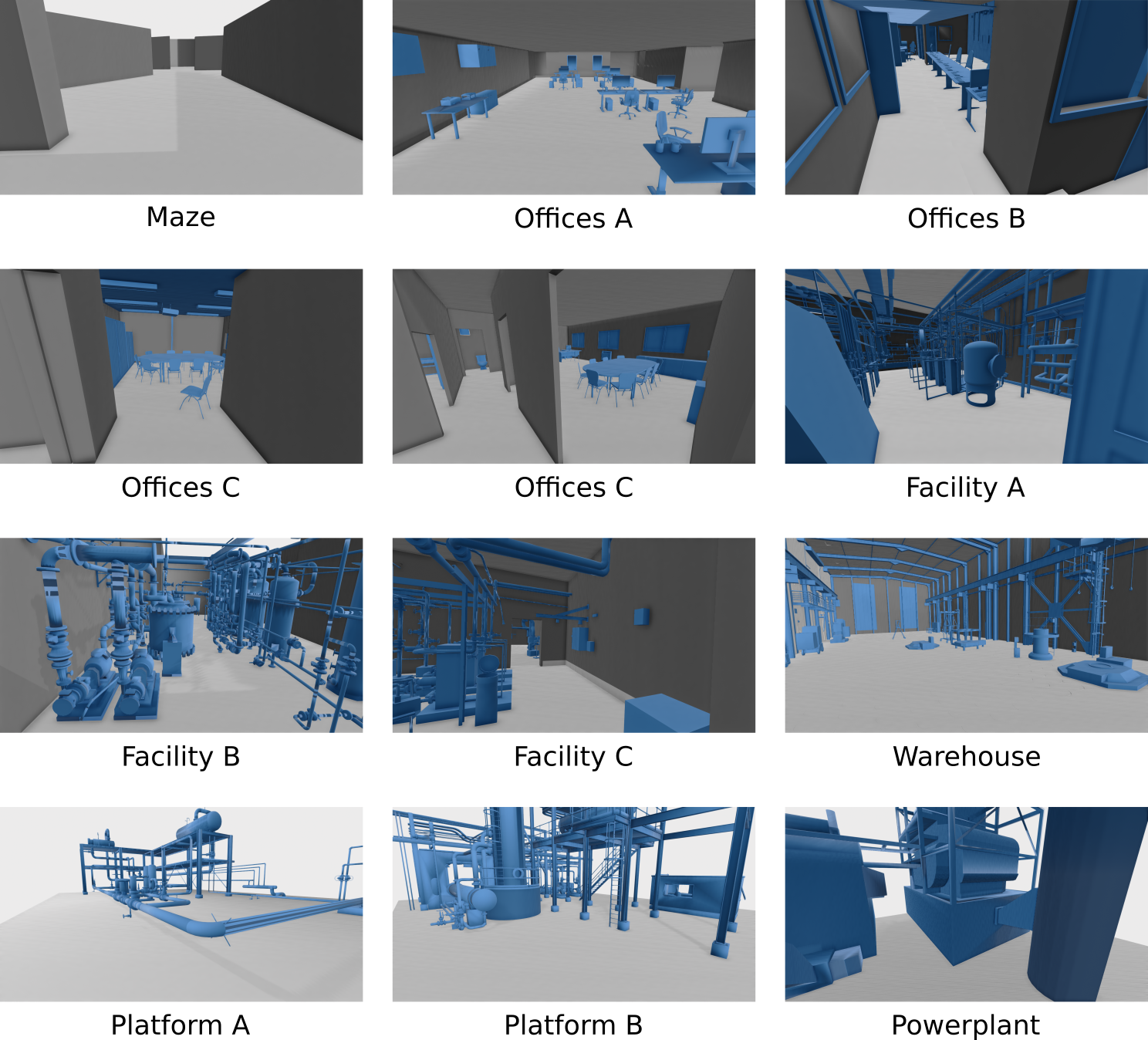
(iii) 11 challenging realistic indoor- and outdoor datasets of increasing complexity and size, with ground-truth.

News

  • (New!) 12/01/2021: The datasets are now available in the Download section!
  • (New!) 12/01/2021: Our benchmarking system is now available online on our github page and our Download section! This includes three planners for now: (i) SplatPlanner, (ii) Classic and (iii) Rapid frontier-based systems!
  • (New!) 12/01/2021: The supplementary material as well as our poster are now available for download!
  • 10/20/2021: The website in its first iteration is now online!

Attribution and acknowledgements

FLYBO is a collaboration between the following institutions and is funded by a french ANRT CIFRE project supported by Gambi-M.

Publication

BibteX

Please consider citing the following work if you use any of the contents provided by FLYBO:

@inproceedings{Brunel3DV2021,
  TITLE = {FLYBO: A Unified Benchmark Environment for Autonomous Flying Robots},
  AUTHOR = {Brunel, Anthony and Bourki, Amine and Strauss, Olivier and Demonceaux, C{\'e}dric},
  BOOKTITLE = {9th International Conference on 3D Vision},
  ADDRESS = {Online, United Kingdom},
  YEAR = {2021}
}

Paper

Supplementary Material

Video (coming soon)


Contents

pareto.png
ABOUT FLYBO

Benchmarks

Summary of our benchmark results showing the state-of-the-art, Pareto-optimal planners (circled in black) with respect to their joint Autonomous Exploration Coverage vs. Online Reconstruction Accuracy ranks on FLYBO. Lower is better for both criteria (see paper for details).


Diagram-sim.png
ABOUT FLYBO

Experimental Framework

Schematic workflow and components of the unified experimental framework provided in FLYBO that allows to evaluate any MAV-based autonomous exploration planning system fairly and accurately for the tasks of volumetric exploration and online 3D surface reconstruction.


ABOUT FLYBO

Datasets

FLYBO also provides 11 challenging indoor and outdoor datasets to benchmark autonomous flying MAVs. The proposed scenes span various levels of structural geometric complexity and scale.

A few selected qualitative results from our benchmarks

quali.png
Different methods exploring various environments autonomously, and reconstructing the perceived premises at different exploration stages.